My photo
read the blog(s) and find out.

Thursday, July 31, 2008

Day 13, July 31st

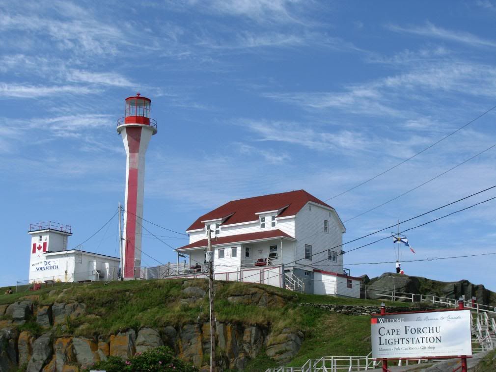
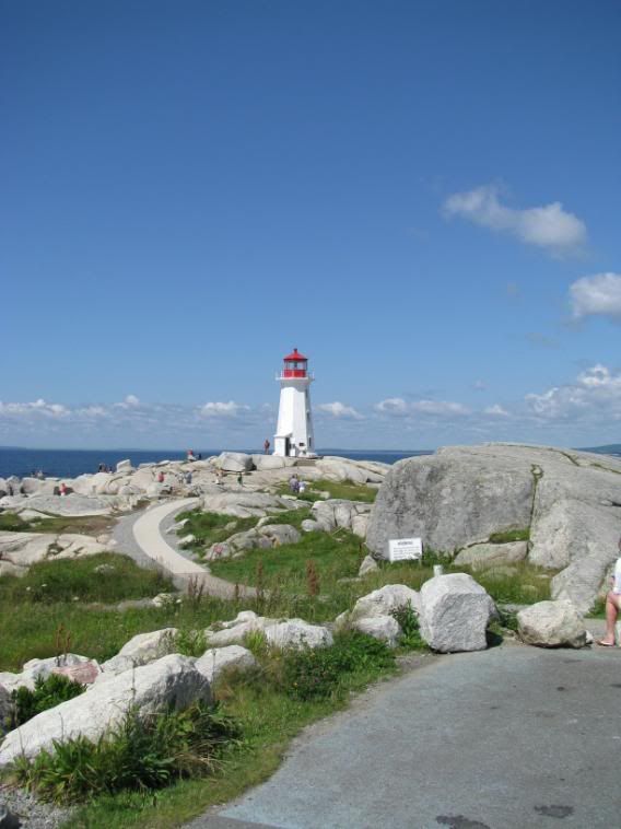
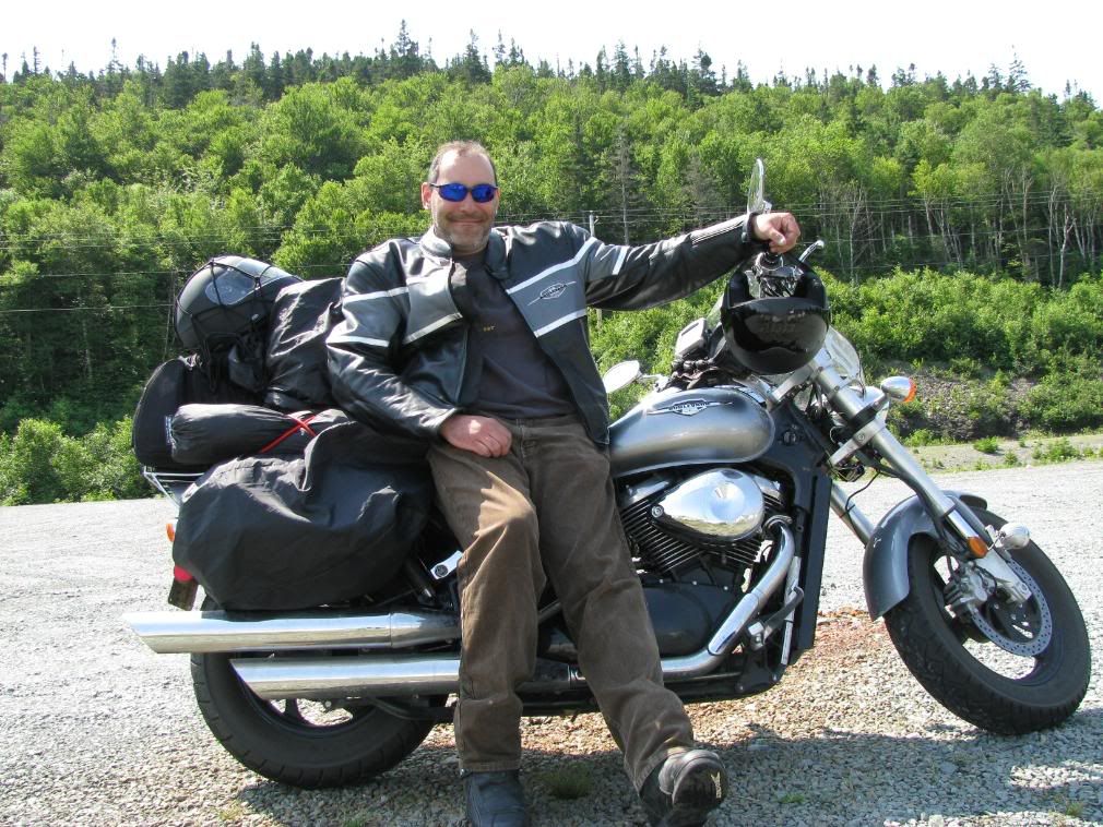
I started the day out by going back to the lighthouse on Cape Forchu and took some pics. it's a funky looking lighthouse and not the same as all the others I had seen so far on the trip. I looked on the GPS and Brier Island looked interesting to go to. I didn't know much about it except that I knew I'd have to take 2 ferries to get there. It sounded a bit adventurous so I went.
The trail on this shore was the Evangeline Trail which has some nice roads cutting through some nice towns on the way up. I stopped along the way because a sign caught my eye... Smugglers Cove. I check
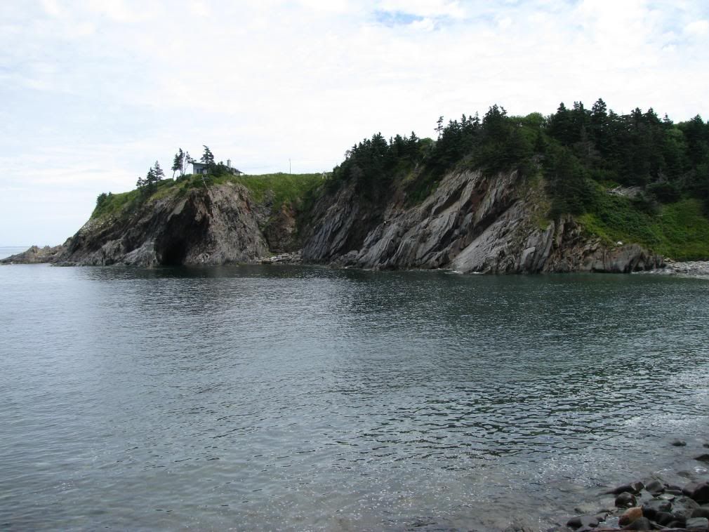
ed it out and it the cove was used by rum runners during prohibition in the United States. Pretty neat little cove, and there was a beach access there. I think it would have been pretty neat to swim into the cove, but knowing myself, I'd probably drown and get smashed up on the rocks going in there. Also that i'm a big chicken. kluck-kluck.

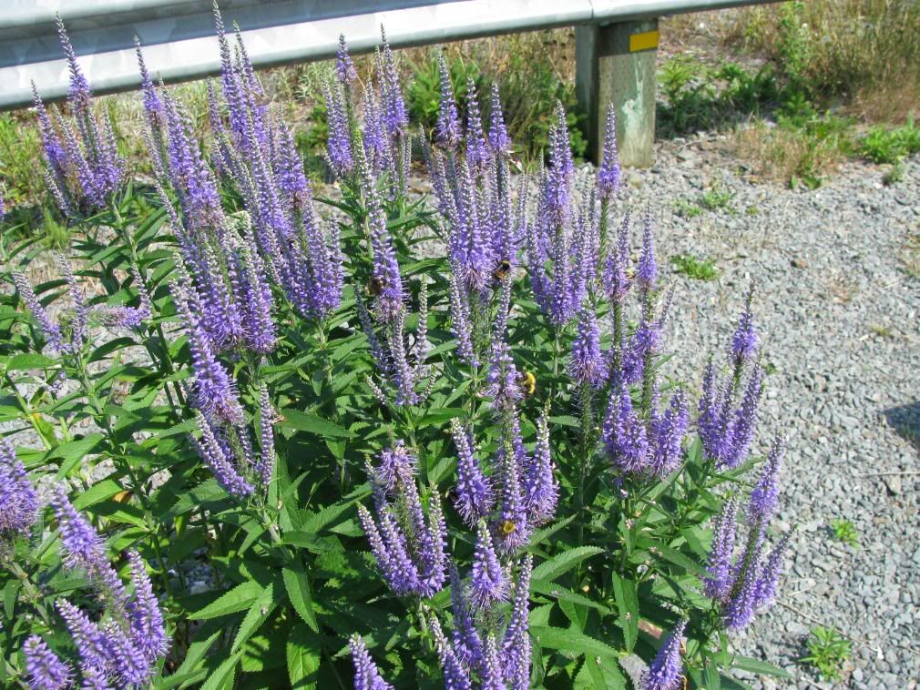
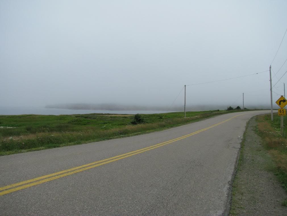
Up to Digby for some timmies and KFC (I know, why??) and rode down the peninsula towards Brier Island. I was a really nice ride down there and enjoyed it quite a bit. This route was the Digby neck and island scenic drive. I took a ferry to Long Island, rode south on that and took a final ferry to Brier Island. It's a tiny Island, but it was really cool to go to such an out of the way place. On the Island there isn't too much except for a few 
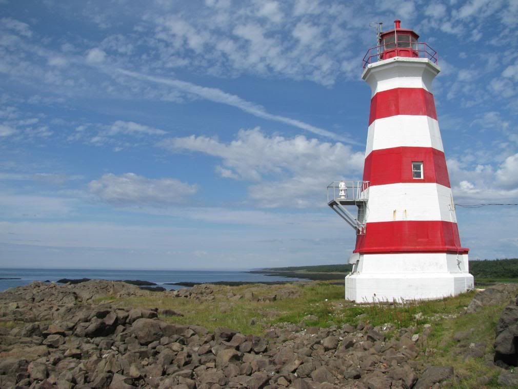
lighthouses, a fishing community and a nature preserve. It was relaxing though even though most of the roads are gravel/dirt.

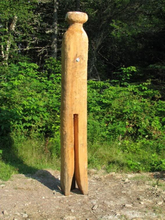
Took some pics, relaxed some more at the lighthouse locations and checked out the monument of Captain Joshua Slocum. He was the first man to sail around the world, alone. This was done between 1895 to 1898. This guy had some balls. It was inspirational to read someone doing a solo trip while I was on one myself. cheesy/corny, I know. There was a little crate with 'Gifts from the Sea'. It was cute and there were all sorts of things like painted shells and painted driftwood. 
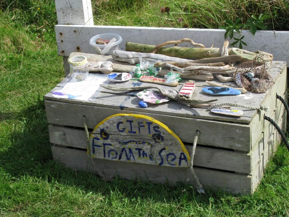
There was also a jar to pay for the items (10 cents to a buck). I bought a small painted piece of driftwood that I found cute. It's better than a t-shirt or hat I think. I got the one in the bottom right corner in the picture.

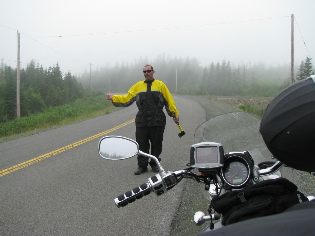
Well, getting late in the day at this point and I wanted to meet up with a friend near Saint John, NB the following day. I figured I'd ride up to Digby and just ferry across to Saint John and save me a trip going the long way around. When I got to the ferry port (around 6pm) the next ferry was at 8:45 and it's 2.5 hours to cross. I would be in Saint John and getting a room somewhere close to midnight. I decided to take the ferry until he told me the price. $90 one way! I thought about it for a few minutes and figured that for $90 of fuel I could ride for about 1200km's. I decided to ride the 'long way round' since slabbing would be about 600KM. Half the price of a ferry.

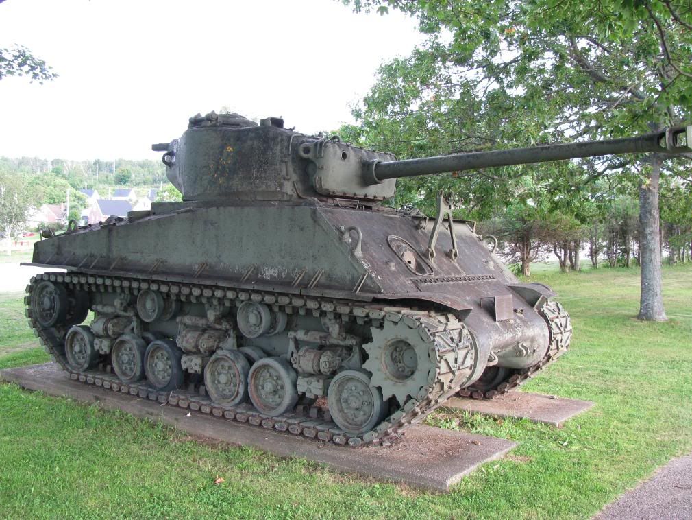
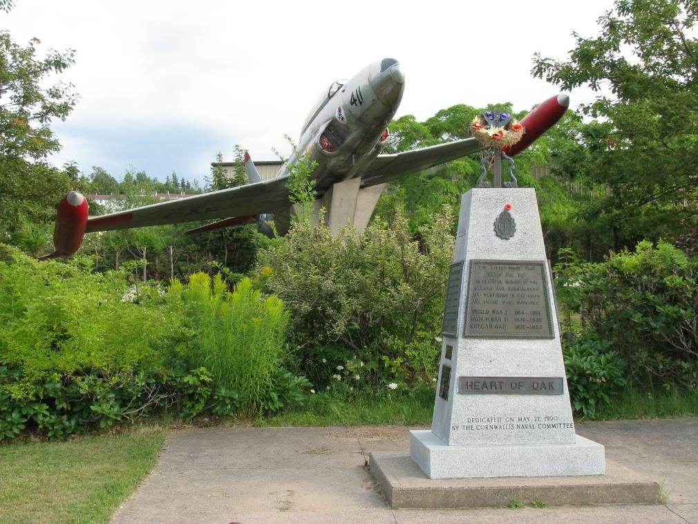
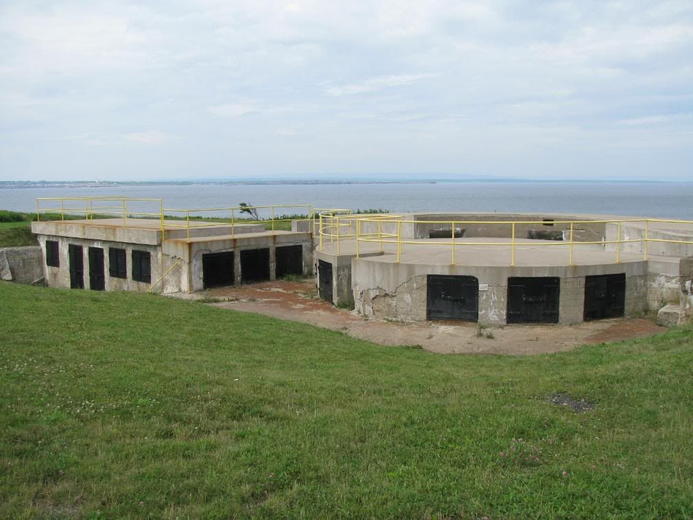
I rode on and the sun set, and kept riding. I alternated between slabbing short bits and going through the towns. The towns I went through were all interesting, but I didn't stay in them for any length of time. I stopped off in Cornwallis as there was a tank and a jet with a monument. nothing else was there...a bit odd. I stopped over for another break at a monument of Bloody Creek. The monument was to commemorate the conflict for the possesion of Acadia in 1757. neato.


Instead of slabbing it down to Halifax and then back north to Truro, I opted to take route 14 which cuts across from southeast to northwest. It was a great route to take at night and I had all my lights on, so I avoided more animals there without a problem. About 10km away from the major highway, the 102, I needed to pee real bad and couldn't hold it any longer. I left the bike running and did my business, figuring it would be a short stop. I got back on the bike and put it in gear, forgetting the kickstand was down. Stupid security feature on the bike kills the engine, but the worst of it was that all my lights flickered and my bike wouldn't restart. It was about 11pm at night in pitch blackness with no traffic to speak of. I had to think.

I figured that since I had all my lights blaring, i must have drained the battery and that's why it wouldn't restart. (I learned later it wasn't the cause) I pushed it down a small hill, hoping to push-start it. didn't work. I pushed it up a bigger hill unloaded the bike and pushed it down as fast as I could. It caught and I was on my merry way once more.

It was really dark and i was stressed so I didn't think of taking any more pictures. I rode on through the night, heading for Truro.

Wednesday, July 30, 2008

Day 12, July 30th

I'm an idiot. I thought that tomorrow was the 1st of August. Nope. I remembered this morning that July has 31 days. Should remember that knuckle trick my folks taught me for remembering how many days in a month there are. Sometimes, we just get too dependant on technology.

I knew today i wanted to see peggy's cove. I think I remember people talking about it, but the only real reason I went down to it was that it looked good on the map, had a sightseeing mark on a map I looked at and through work I worked on circuit troubles in the area

From Dartmouth i rode through Halifax and took 2 pictures. One of Cornwallis (founder of Halifax) and one of Alexander Keith's Brewery. I wasn't on the east coast for the cities, I was out there to ride. The tourist traps can wait for the next time I'm in that area.

The Lighthouse route along the 'Southern Shore' is fantanstic. If you're on a motorcycle, get the Nova Scotia Motorcycle Travel Guide. It gives all the routes and what to see along the way. Even for non-motorcyclists it's useful, but they have other guides on the website for you cagers.
Peggy's cove was absolutely amazing. I fell in love with the place. I must have been there for a few hours... I can't remember as I lost complete track of time. I stayed there longer than I should have but I figured that it was worth slabbing it if I had to.

Further down the road there was a monument for Swissair flight 111. 229 perished off these shores 5 miles out. Cause was a fire on board that couldn't be contained. nasty. And they saw motorcycles are dangerous. heh.


That much time in one spot i must have taken about 300+ pictures. Many were on continuous shot so I could get of the water splashing around, but it's a digital camera with a lot of memory, so why not?

There was a small beach on the side of the trail so I stopped for a smoke and thought it would be nice to at least stand in the atlantic before I miss it completely. There wasn't anyplace to change or else I would have swam there. I rolled up my jeans to my knees and went into the water up to my ankles. The waves come in high enough that Iwas soaked to mid-thigh. heh. I'm dumb. I rolled them back down and kept riding. They were dry in about 10 mins, so I wasn't uncomfortable for long. Pic of the place I walked on water... ok, not on, in.
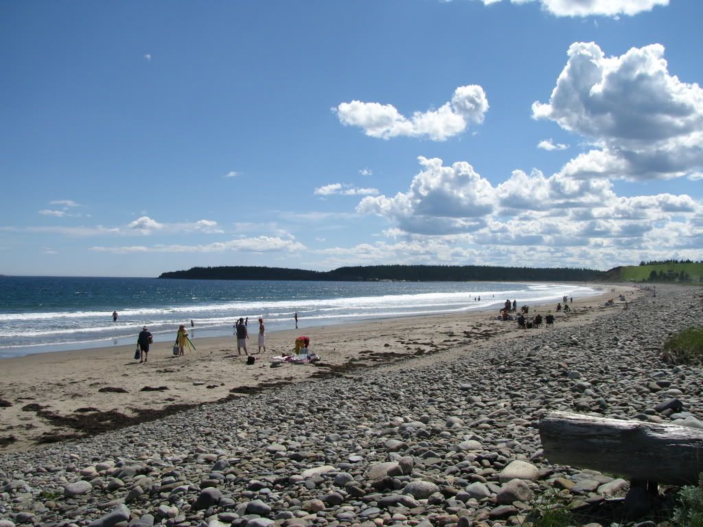
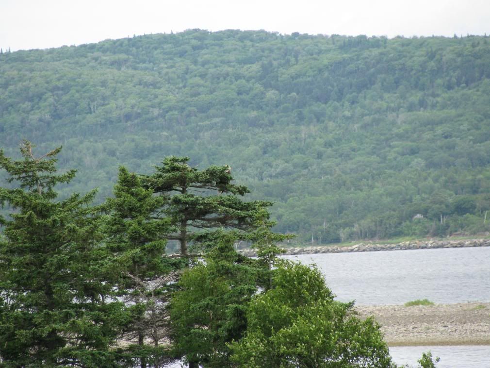
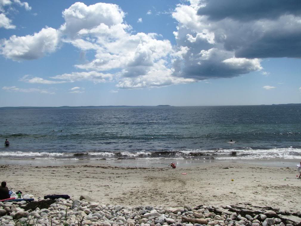
On the big highway (the trail and highway intersect) I saw a sign for the Bluenose II and took the turn off. Didn't know where It was, so I rode around for a bit and asked an tourist info person in Mahone Bay where I'd find the ship. The ship was docked in Lunenberg a few mins down the road. No one in the east measures distances in KM, it's always in time. odd. I chatted her for a few mins and I told her i never swam in the Atlantic, but that day I waded in for a bit. She gave me this photocopied hand-drawn map of the area which showed Hirtle's Beach. She said it was a great beach with nice sand.
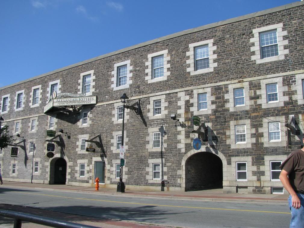
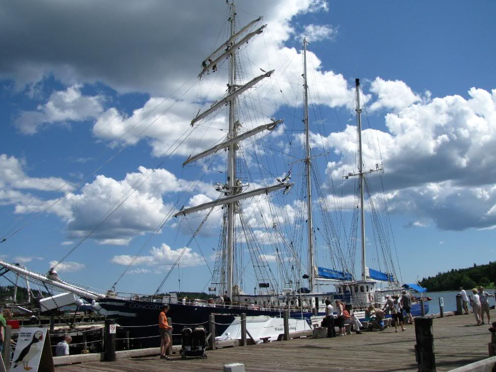
Lunenberg is a really nice town and for anyone in the area they should really visit it. Saw the Bluenose II and another tall ship and the town itself had a lot of historic presence. I'd like to go back there and hang out for a day, but it is very 'touristy'. For those of you who don't know, the original Bluenose you can read about it here. It's on the 10 cent coin, in case you didn't know what that ship what.

Took a look of the hand drawn map and figured it was now or never to go swimming in the Atlantic. Luckily there were restrooms (outhouses) that I could change in. The beach was very beautiful and waded in. The water was so cold I think my berries crawled back up inside me. I finally dunked myself and swam for a bit and I was instantly freezing. It was such a hot day riding, especially with all my riding gear on and with the contrast of the coldness of the water, I think my body was going into shock and I was almost hyperventilating. I had never tasted seawater before and got splashed in the mouth from the waves. Salt water is pretty gross.

After drying off and changing, I kept on the Lighthouse Route heading south and really enjoyed the ride there. I went to Port La Tour, since I saw it on the GPS and I think I had heard about it through work. There wasn't much there but I was on the side of a road near the harbour when a guy and his son stopped their truck and chatted with me. In Ottawa, you don't talk to strangers much... out here in the east, it's expected. It's a different experience, that's for sure.

Leaving there I headed to Barrington Passage. On a country road an animal that looked like a dog darted out of the ditch on my left side and was heading right for my wheels. A honk scared him long enough to stop and look so I could swerve around it. It was a coyote!

Yay for timmies in Barrington Passage. I asked a few people about motels in the area and it seemed there was really only a B&B or two around here. It was late in the day ~7:30 so I flipped a coin wether to go straight to Yarmouth, or search around locally for a place to sleep. Yarmouth won the coin toss and off I went, sticking to the lighthouse route until around Argyle when I slabbed it until Yarmouth.

Got a room at around 10:30pm or so and went back out for some night riding around town for food and some sights. Rode to the lighthouse on Cape Forchu, which is a nice ride really, and on the way back avoided a family of 3 racoons in the middle of the road. Yarmouth is nice, but there's not a whole heck of a lot there.

Tuesday, July 29, 2008

Day 11, July 29th

I look like an absolute tard in this picture. Oh well, I'll take what I can get. I stopped here because of a historic site. Seems Prince Henry Sinclair landed on these shores in 1398, many years before Cabot did. Then again, who cares, the Vikings were here in 1000AD. It was a nice place to stop for a break and watch the 20+ bees in one plant alone. they were all over the place but with the flowers growing there, I wasn't too fearful of the bumblebees. It was an interesting stop at any rate.

I continued along route 344 heading towards Canso. The road was rough in parts and didn't have that many views. Got to Canso and didn't feel like stopping much, but I went to the Harbour and relaxed for a few mins. Heading out of Canso I saw this monument to the fallen. Even in a little village like Canso, people died in the wars. So sad. Left Canso and headed south.

Had I known how the Eastern Shore was, I wouldn't have ridden it. To any riders out there, I suggest you skip the Eastern Shore. I almost fell asleep during the day. The roads were really rough and sucked and there's a lot of nothing with no views... hence no pictures. It was in this area I forgot how to counter-steer in a curve and almost ran into a ditch. Luckily i figured out what I was doing wrong and only had to look where I wanted to go to get out of trouble. close call. This is also the stretch of road that i almost hit a chicken looking bird. damn thing was in my lane and wouldn't move.

There was a neat little Acadian commemorative park in Larry's River that had 10 painted rocks depicting the settlement of the area. It was nice to see the origins of the people of the area in that way.
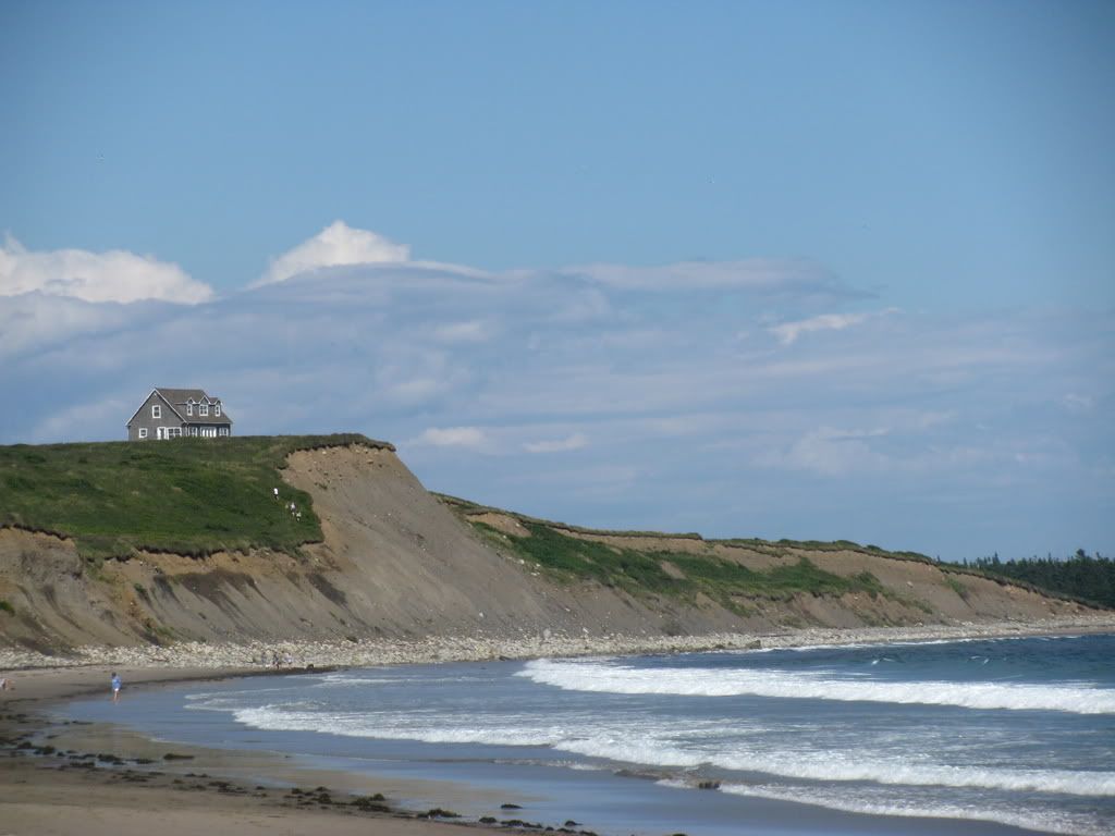
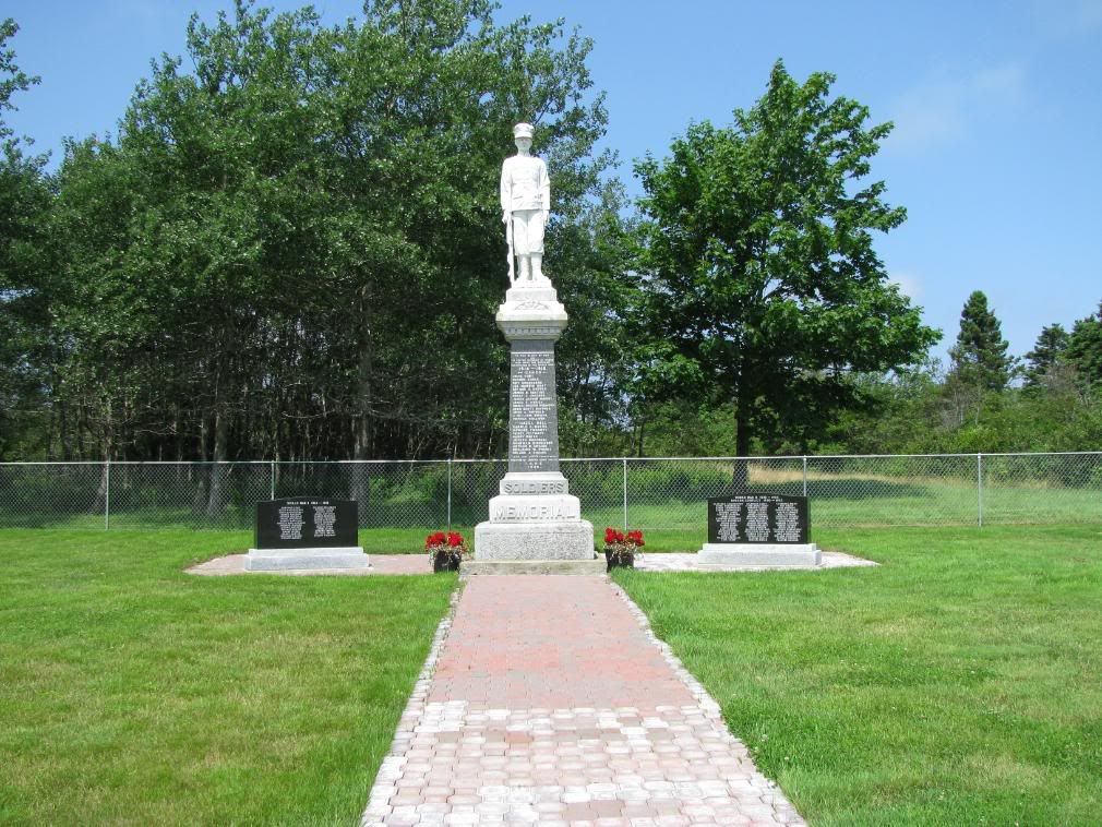
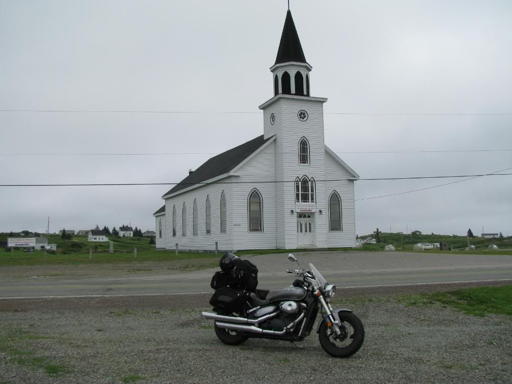
Across the road from this commemorative park, there was an old church that was built a long long time ago, and there are a few pictures of it over time, so I had to get the bike in the picture too.
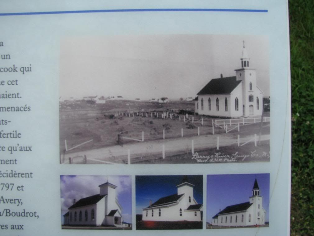
Onward I went and I had read about a ferry crossing at Country Harbour, so I decided to take it and stay near the coast. $5 for a 10 min ride. Worth it to skip more crappy roads. The roads started to get a bit better heading to Sherbrooke village. that part was a nice ride.

Finally reached Sherbrooke Village and fueled up. I guess I was lucky since the Wilson's gas station there had not only fuel, but cooked food, laundry and ice cream. It cost $2 to wash and $4 to dry, but it was well worth it to have clean laundry again that I could put back into my Ziplock baggies. If you ride, put your clothing in Ziplock, you'll thank me later. a) it uses less room b) keeps clothing dry c) you can see through the bags what you got left that's clean :)

Stopped in sheet harbour since I had to pee real bad. Nothing was opened so it was going to be bushes for me. I decided to take pictures of a some wooden 'big things' and noticed a river nearby, and I didn't take much notice before when I rode over it but others were taking pictures. It was relaxing to watch the river /falls/ rapids.

I continued down the coast and got a place in Dartmouth for the night. I figured that I only had a six days of riding to get home for the 6th so I wanted to push as far as i could each day.

Monday, July 28, 2008

Day 10, July 28th

Saw a giant fiddle, so i needed to take a few pics of that! A nice couple walked by and asked if I wanted my picture taken with the bike. Of course I did, and she took a pretty good picture I think :)

I Left Sydney and went north up the coast and noticed a church looking building, with a tank beside it. I didn't notice the sign at first, but it was the Fort Petrie historic military museum. Talked to the guy there and we talked quite a bit about war, etc. the building was made to look like a church to fool the nazis. There was also an under submarine net to catch nazi subs if they came into the channel to the Sydney harbour. It was a great find on the side of the road and quite unfortunate that not much money has been put into places like this preserving our history. The museum ran only on donations, so I gave $5. Funny how I'll give money to small museums like this, but refuse to spend money on the 'real' museums.

I got to walk around the Bunkers where the anti-aircraft guns would be, and I would hate to have been in there when we were at war.

If you are in the area, I suggest you check it out.

I followed the coastline to glace bay and got to the Marconi historic site. I would have thought that there would be more of the original 'workings' at the site of the 1st transatlantic complete wireless message. It was still interesting to go to, and most of all, it's free. Still neat to imagine in 1902 a complete wireless message was sent from Glace Bay to Ireland at a time when Canada was still forming.

I took the Marconi Trail, heading to Lousibourg, the fortified historic site. about 5 mins from Louisbourg a freak storm came down hard out of nowhere. I wasn't wearing any rain gear, and by the time I was able to pull over safely I was already soaked to the bone.
note to self: if they call for rain in the area, wear the rain suit, even if you look goofy
This picture was taken about 15 mins before the downpour. When riding in fog, wear rain gear!

I pulled into Louisbourg and covered my bike with a tarp I brought. I hadn't put the rain covers on the bike either. After the rain stopped about 10 mins later, i decided to change on the side of the road. Cold, wet and nekkid with a big blue tarp around me. heh. quite an experience.

Thankfully, since I had put most of all my clothing in Ziplock bags, I had dry clothes to wear. I felt a bit miserable at this point so I decided to just ride on. I didn't feel like visiting anything. It was pretty Much fog and trees all the way south, but it finally cleared up late in the day.
I had arrived at Port Hastings at the 'entrance' to Cape Breton and decided to get a room for the night and get a head start for the next day. I didn't really, what i did was go riding at night. Avoided some more critters along the way, and had a bat fly next to me for a few seconds and had a firefly buzz by. Even at night you can get interesting sights.

Sunday, July 27, 2008

Day 9, Part 3

Back on the Cabot Trail I road east until Cape North. I stopped for Gas and chatted with the woman running the place. I told her about Stupa and she wasn't surprised. She told me that had i kept going a little bit further, I would have seen their monestary, which you can visit unless it's the dinner hour. At that time, it's complete silence and visitors aren't allowed. I'm kicking myself for not going all the way to the end of the road, but what can you do. Maybe I'll go next year. Going north I pulled over to take a picture of this Estuary. I liked it.


I headed north and the GPS said that a historic site was up here called Cabot's Landing. People think that John Cabot discovered the continent of America at this location in 1497. The Cabot Dilemma No one can prove where he landed it seems.


It's still neat to think that somewhere around where I was Cabot found the continent. (personally I think he found Newfoundland)


There was a nice beach here, but I didn't feel like going swimming at this time. heh. Maybe I'm afraid a big sea turtle will think my toes are lunch.

I headed north and wanted to get to Meat Cove as I had heard through work that this was a remote spot and the road was bad going up there, so I knew I had to see it for myself. The road was rough but great at the same time (i think about 13 km of gravel/dirt) and almost ran over a suicidal chipmunk, but I missed him and he ran back to the trees. stupid chipmunk. Stopped a few places on that road and enjoyed the view. You do get the sense of how remote this area is. It's one road and there's no other way out but the way you come in. here's a view overlooking the campsite at Meat Cove from the road. From the trails off of Meat Cove people can whale watch from the shore as they swim by. I didn't do that myself... need to get in shape if I'm going to be doing any hiking!

Left Meat Cove and as usual, stopped to take pictures along the way. Some really nice scenery in this area. I stopped at a little fry hut called "The Hut" for a dog and fries and headed back south, hoping to find a room somewhere before dark.

The road south was nice, stopped a bunch of places along the way and made my way to the 105, which i followed north to Sydney. Got a room and went back riding in the area. some nice little communities there and had a nice sunset near Point Edward.

Day 9, Part 2

STUPA


Coming around a bend, I see this very large monument/statue of Stupa. I was quite stunned to say the least as there's pretty much nothing but a dirt road and trees on both sides, and to one side on a little clearing, is this very bright white buddhist monument. it seemed a little out of place at first, but then it didn't. it was peaceful reading the slogans and saying which were inscribed in stone around it.

I liked these slogans, when applied to riding.
well, the last one at least. Don't try to be the fastest. goes with motorcycling and as the saying goes there, it's "ride your own ride"
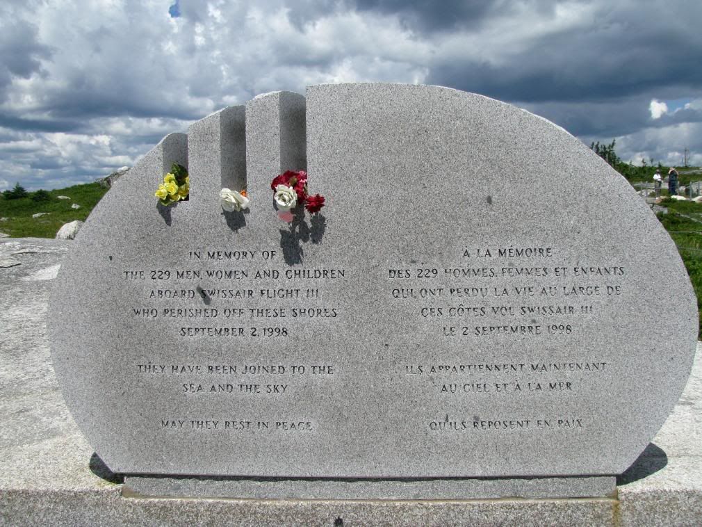
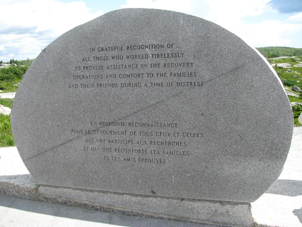
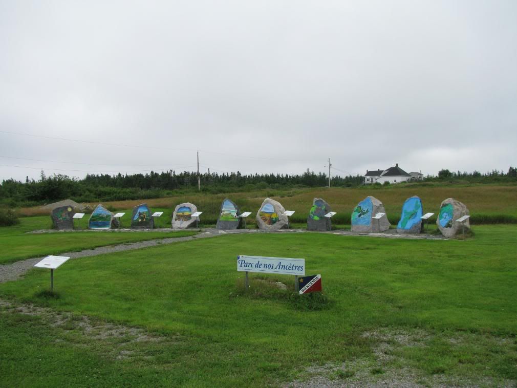
I read the stones and sat around for a bit and relaxed. The more I thought about it the more it made sense to put this were it was. nothing around to distract you. I'm not one for meditation and religion and all, but if I were, this would be a perfect spot for it.

I got back on the bike and went about 100 yards further down the road which dwindled down to two ruts and was getting really narrow. I figured it was a driveway for a private residence, so i turned around and headed back to the Cabot trail.

There was a little store on the Cabot trail to get some smokes and some food and I picked up a pepperoni stick that was packaged with a cheese stick. It was the oddest thing ever and a good little snack on the side of the road. wish I could find that around here, but I guess I could always buy pepperoni and just cut some cheese. I also bought a pack of 'Bailey's' which have an biodegradable filter. neat to see that, but the smokes sucked.

-to be continued-

Day 9, July 27th

Slept poorly in the tent. Back isn't used to hard gravel ground. I used one of those little blue pads you can buy, but it's crap. To add to that, i had some kind of forest rat rummaging through my luggage that was under a tarp outside the tent. Don't think I had any food in there. At first i thought it may be a bear (there are some in the park I was camping in) but i got up and went out to look. I scared away the little chipmunk. damn him. The shower at the park was one of the best I've had all trip. The water was hot and there was a lot of pressure. Packed up and checked out of the camping spot.

note to self: get inflatable mattress.

Today I was going to do the Cabot Trail in the Cape Breton Highlands National park. I was all psyched since people were telling me it was the best thing since sliced bread.

The western shore of Cape Breton through the park is quite a nice ride with many places to pull over and look at the scenery of the coast. Once you turn more inland the road is still nice, but looking at trees can get a little boring.

I was looking at the GPS and I could see a road splitting off the Cabot Trail at Pleasant Bay, going north to Red River. I didn't know what was there as I didn't read any guides or touristic information on the area. I just felt like exploring, and figured if there's a road, there's usually something interesting at the end of those roads. I decided to turn off Cabot Trail onto that dirt road in Pleasant Bay. It's a gravel/dirt road and anyone that saw me waved to me. Nice people in these parts. Slowly continued on this dirt road and then about 8 km later, a buddhist statue!!

Today was to be a very long day, leaving the campsite at around 9am and getting a room at a motel that night at about 9pm, only having gone about 400km. but many pictures were taken and and I had a pretty good day in general.
-continued in next post-

Saturday, July 26, 2008

Day 8, July 26th

Woke up and got my morning coffee at a Timmies and decided to up the coast and see what's up there. I followed the Sunshine trail i believe it was called up to Cape George. it was a nice ride, the roads were good and the views were really nice. got up to the Cape George lighthouse, and snapped a few pics there. It was a really nice site, high above everything

I really liked Cape George... it was very peaceful. I keep saying that, maybe i was just looking for some peace and quiet and solitude. Guess i found it in little bits.


Did the loop of the sunshine trail and it comes back to Antigonish. I figured that since Antigonish was a university town, there would be an internet cafe somewhere around there. Bingo. Found one. used it for about 45 mins and it cost me $2.40 i thought he was kidding me. I've used an internet cafe at one place in montreal and it cost me like $20 for an hour. heh.

Off to Cape Breton!

Right before i hit the Canso Causeway canal, I stopped for fuel and food at the Irving truck stop there. Good food. While chatting with the waitress about my camera and she loved the 10x zoom on it, she said i could probably take a picture of the bald eagle from where I was sitting. it's nest was far away in a tree, and could barely make it out. when I finished eating I went out and took a picture as close as i could, which isn't much, but thankfully high-rez and zoom works well :) here's the original picture... i reduced it/cropped it to get this. Not the best picture but at least I got a bit of it.
Hopped on the bike, went across the causeway and made a snap decision as to go clockwise or counter-clockwise around Cape Breton. Since I was going clockwise around the maritimes, I decided to keep with the theme and took a left. I didn't go to the Cabot Trail as i wanted to stick next to the coast. I landed in Port Hood and little did I know it's Al MacInnis' home town. woot. cute little town. little is the key word here. I kept going north and eventually got to Cheticamp. no vacancy on any motels to be found, so since I had some camping gear, i decided to camp out for the night (it wasn't supposed to rain that night) and headed for the park for a camping spot.

I went back to a store I saw on the way to the park and they advertised camping supplies. woot. Walked in and got some fire starter, an axe, hot dogs, beans, milk, bread and water.

Like J.G. said, what you forget or don't bring, you can buy... he was right got back to the campsite, loaded up the wood I bought there (you have to bring in or buy there since it's a protected park and you can't even burn dead wood, branches or twigs)
had myself a fire, cooked my food and entertained myself with my lamp